OLD TOWNS BOOKS & MAPS
Old Maps of Somerset
Essentials for Local Historians, Genealogists & Family Historians
MODERN MAPS
LOOKING FOR A DETAILED MODERN ORDNANCE SURVEY MAP OF A SOMERSET TOWN? CLICK HERE
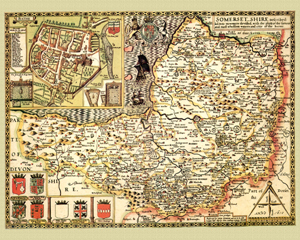
Somerset in 1610
by John Speed
Size: 16 x 20 inches
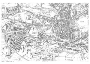
Bath in 1902
Size: 21.5 x 15.25 inches
Scale: 14 inches to the mile
Type: reproduction
CLICK MAP TO ENLARGE
PRICE: £7.99
Showing the area from The Circus in the north to Alexandra Park in the south, and from Twerton Cemetery in the west to North Parade Bridge in the east.
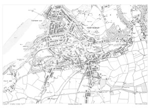
Clevedon in 1902
Size: 21.5 x 15.25 inches
Scale: 14 inches to the mile
Type: reproduction
CLICK MAP TO ENLARGE
PRICE: £7.99
Showing the area from the Franciscan Priory in the north to Tutton Farm in the south, and from Church Hill in the west to All Saints Church in the east.
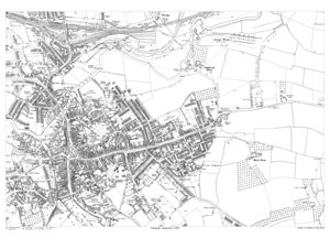
Taunton in 1903
Size: 21.5 x 15.25 inches
Scale: 14 inches to the mile
Type: reproduction
CLICK MAP TO ENLARGE
PRICE: £7.99
Showing the area from Obridge in the north to the Franciscan Convent in the south, and from Shire Hall in the west to Moor Farm in the east.