OLD TOWNS BOOKS & MAPS
Old Maps of Shropshire
Essentials for Local Historians, Genealogists & Family Historians
MODERN MAPS
LOOKING FOR A DETAILED MODERN ORDNANCE SURVEY MAP OF A SHROPSHIRE TOWN? CLICK HERE
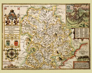
Shropshire in 1610
by John Speed
Size: 16 x 20 inches
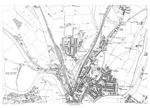
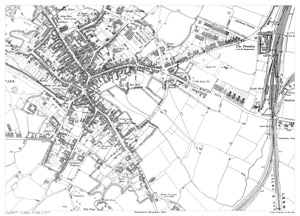
Shrewsbury (east) 1900
Size: 21.5 x 15.5 inches
Scale: 14 inches per mile
Type: reproduction
CLICK MAP TO ENLARGE
PRICE: £7.99
Showing the area from Cleveland Street in the north to Oaklands in the south, and from Wyle Cop in the west to Robertsford in the east.
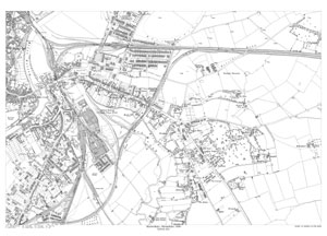
Shrewsbury (north) 1900
Size: 21.5 x 15.5 inches
Scale: 14 inches per mile
Type: reproduction
CLICK MAP TO ENLARGE
PRICE: £7.99
Showing the area from The Six Bells pub in the north-east to the prison in the south, and from Shropshire & West Midland Agricultural Show Ground in the west to Newpark Farm in the east.
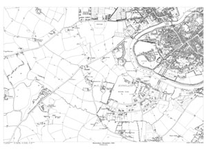
Shrewsbury (west) 1900
Size: 21.5 x 15.5 inches
Scale: 14 inches per mile
Type: reproduction
CLICK MAP TO ENLARGE
PRICE: £7.99
Showing the area from the Infantry Barracks in the north to Kingsland Grange in the south, and from Copthorne in the west to the High Street in the east.
Whitchurch 1899
Size: 21.5 x 15.5 inches
Scale: 28 inches per mile
Type: reproduction
CLICK MAP TO ENLARGE
PRICE: £7.99
Showing the area from the Cottage Hospital in the north to Paul's Moss in the south, and from the Gas Works in the west to the Railway Station in the east.