 |
HOME | BOOKS | PRINTED MAPS | MAPS ON CD-ROM | GENEALOGISTS | CONTACT US | PRIVACY |
||
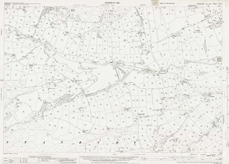
Old Ordnance Survey Maps of Yorkshire - Sheet 200. 9. 1934
Ponden Reservoir area in 1934
Scale 1:2500 or 25 inches to the mile : Original map size 40 x 29 inches [102 x 74 cms]
[see modern map below]Shows the farms and houses in the area of Dean Fields, Dean Edge Quarries, Ponden Reservoir, Ponden Bridge, Ponden Mill, Scar Top, Oldfield, Griff Mill, Hob Hill.
TO CONFIRM A LOCATION ON THIS MAP, PLEASE EMAIL US YOUR QUERY BEFORE PURCHASE.No additions.
PURCHASE
300dpi scan of the map seen below
complete with any additions as described above
£5.99

LARGE PRINTED MAP
Near full-size colour print of the map below.
33 x 24 inches on 120gsm coated paper.
Posted rolled in a tube.
£12.99
< Return to Menu >
Modern equivalent area from Google Maps
[NOTE- approx. area only - please email if you need to confirm a location on the old map (above) before purchase]
View Larger Map