OLD TOWNS BOOKS & MAPS
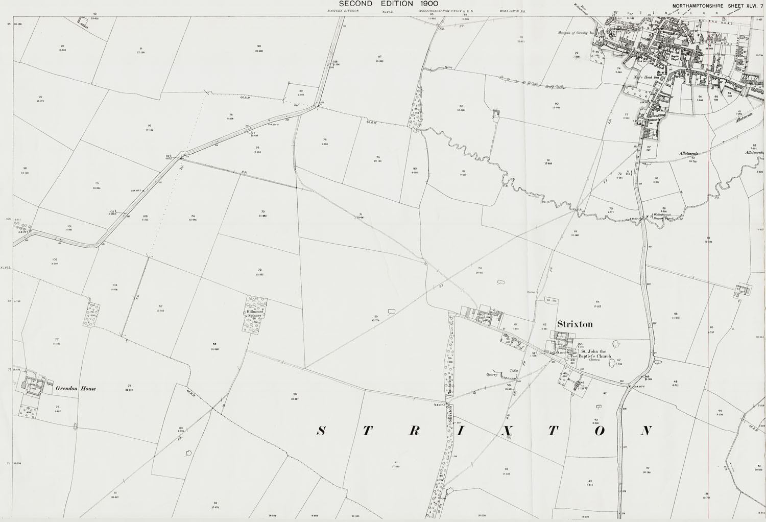
Old Ordnance Survey Maps of Northamptonshire - Sheet 46-7
Scale 1:2500 or 25 inches to the mile : Original map size 40 x 29 inches [102 x 74 cms]
.........................................................................................................................................................................
Strixton, Wollaston (south) in 1900
PDF DOWNLOAD: full size 400dpi scan of the original map, complete with all marks and additions as seen below. Our downloads are high quality with no pixelation even at reasonable high zoom levels (see Sample, below).
PRINTED MAP: A flat-sheet map measuring 33 x 24 inches (84 x 61 cm). Printed on 120gsm matt coated paper with HP fade-proof inks, with all marks and additions, as seen below. FREE SHIPPING rolled in a postal tube
INSTANT PDF DOWNLOAD £5.99 |
 |
LARGE PRINTED MAP £11.99 |
TO VIEW A SAMPLE MAP IN YOUR DEFAULT PDF VIEWER (i.e. Adobe Reader) >> CLICK HERE
You should ensure the "Hand Tool" is enabled, and experiment with the "Zoom" tools.
You will be able to zoom in closer than you will ever need, without loss of quality.