OLD TOWNS BOOKS & MAPS
Old Maps Lancashire
Essentials for Local Historians, Genealogists & Family Historians
SEE ALSO: SOUTH LANCASHIRE IN 1934 FOR COMPLETE COVERAGE OF THE AREA
BACK TO LANCASHIRE MAPS >
AVAILABLE AS INSTANT DOWNLOAD OR LARGE FORMAT PRINT SHOWING:
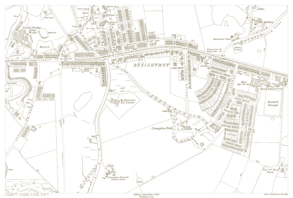
Bolton - Breightmet area, Lancashire in 1930
Showing the area from St. James's Church in the north to Crompton Fold Pit in the south, and from Oakenbottom Road in the west to the football ground in the east
GENERAL DETAILS:
Reproduced from an Ordance Survey original map.
These maps show incredible detail, including individual houses, wells, water pumps, letter boxes, footpaths, etc.INSTANT DOWNLOAD: £5.99
Full size PDF format maps at 400dpi, with instant secure download at purchase, no delay waiting for an email link. To be viewed in Adobe Reader or similar software. Zoom to 400x in for amazing detail.

LARGE FORMAT PRINT: £7.99
Large, brand new modern reprints
PRINTED AREA: 20 x 16 inches
FLAT-SHEET MAPS (not folded)
P & P £2.00, SENT NEXT WORKING DAY
ROLLED IN A CARDBOARD TUBE