OLD TOWNS BOOKS & MAPS
Old Maps of London & Greater London in 1932
Essentials for Local Historians, Genealogists & Family Historians
THERE ARE 109 MAPS IN THIS SERIES, SO IF THIS IS THE WRONG MAP CLICK THE LINK BELOW TO VIEW THEM ALL
SEE ALSO London 1723-1900 series, London 1888 series, London on CD-ROM sets
BACK TO LONDON 1932 MAPS >
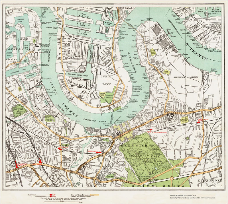
THIS IS SHEET 79-80
AVAILABLE AS INSTANT DOWNLOAD OR LARGE FORMAT PRINT SHOWING:Millwall, Deptford, Greenwich
Cubitt Town, parts of Surrey Commercial West India Docks, Shooters Hill
GENERAL DETAILS:
Showing an area of 3 x 2.5 miles, the printed area of the map measures approx. 46 x 41 cm.
Named items include roads, farms, public buildings*, larger houses, woods, rivers, estates & parks.
Also showing footpaths, ponds & lakes.
ALL RAILWAY LINES AND STATIONS ARE NAMED
*hospitals, libraries, town halls, churches, schools, colleges, museums, gas works, sewage works, etc
Full size PDF format maps at 400dpi, with instant secure download at purchase, no delay waiting for an email link. To be viewed in Adobe Reader or similar software. Zoom to 400x in for amazing detail.

LARGE FORMAT PRINT: £9.99
A large, brand new modern reprint of the original
Printed on matt white background, but the map retains the colours & tones of the original.
PRINTED AREA: 46 x 41 cm
A FLAT-SHEET MAP (not folded)
SENT NEXT WORKING DAY ROLLED IN A CARDBOARD TUBE