OLD TOWNS BOOKS & MAPS
Old Maps of Lincolnshire
Essentials for Local Historians, Genealogists & Family Historians
MODERN MAPS
LOOKING FOR A DETAILED MODERN ORDNANCE SURVEY MAP OF A LINCOLNSHIRE TOWN? CLICK HERE
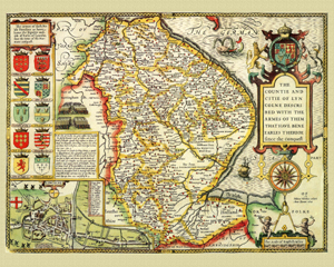
Lincolnshire in 1610
by John Speed
Size: 16 x 20 inches
GO TO THE JOHN SPEED PAGE
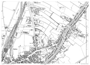
Spalding (north) 1903
Size: 21.5 x 15.5 inches
Scale: 28 inches to the mile
Type: reproduction, flat sheet
CLICK MAP TO ENLARGE
PRICE: £7.99
Showing the area from the Workhouse in the north to Herring Lane in the south, and from the Railway Station in the west to the Exeter Drain in the east.
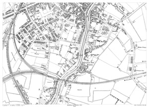
Spalding (south) 1903
Size: 21.5 x 15.5 inches
Scale: 28 inches to the mile
Type: reproduction, flat sheet
CLICK MAP TO ENLARGE
PRICE: £7.99
Showing the area from the Corn Exchange in the north to Welland Inn in the south, and from Havelock Street in the west to Stone Gate in the east.