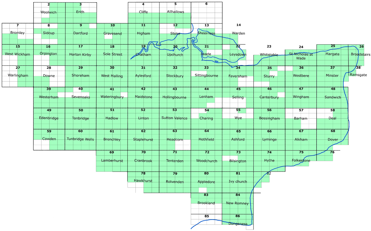
Find old Ordnance Survey maps of nearly all Kent towns and villages by clicking the KEYMAP (below).
ALSO SEE - Kent Ordnance Survey 1:25,000 First Editions (1940's & 50's) CLICK HERE
..................................................................................................
MODERN MAPS
LOOKING FOR A DETAILED MODERN ORDNANCE SURVEY MAP OF A KENT TOWN? CLICK HERE
..................................................................................................
* These are high quality Adobe pdf files, available for instant download 24 hours a day.
Please note, these are complete maps, NOT A3 SECTIONS as provided elsewhere.
They are printable to A2 size and larger, or smaller sections are easily printed using the Adobe Reader printing tools.
Remember to experiment with the Zoom control for optimum viewing.
If you are familiar with Kent, select an area to view by clicking the keymap below: (hold cursor over names for more details)
or CLICK HERE if you are not sure of the exact location.