OLD TOWNS BOOKS & MAPS
Old Maps of Dorset
Essentials for Local Historians, Genealogists & Family Historians
MODERN MAPS
LOOKING FOR A DETAILED MODERN ORDNANCE SURVEY MAP OF A DORSET TOWN? CLICK HERE
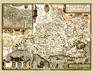
Dorset in 1610
by John Speed
Size: 16 x 20 inches
GO TO THE JOHN SPEED PAGE
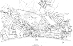
Town Plan of Bournemouth, Dorset in 1900
Size: 22.5 x 14 inches
Scale: 6 inches to the mile
Type: reproduction
CLICK MAP TO ENLARGE
PRICE: £7.99
A modern print showing the area from Luther Road, Winton, in the north, to The Pier in the south, and from All Saints Church in the west, to Boscombe Railway Station in the east.
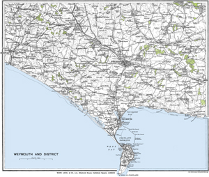
Weymouth & District, Dorset in 1928
Size: 18.5 x 15.5 inches
Scale: 0.75 inches to the mile
Type: reproduction
CLICK MAP TO ENLARGE
PRICE: £7.99
A modern print showing the area from Bridport in the west to East Burton in the west, and from Cerne Abbas in the north to Portland in the south.