HOME | BOOKS | PRINTED MAPS | MAPS ON CD-ROM | GENEALOGISTS | CONTACT US | PRIVACY
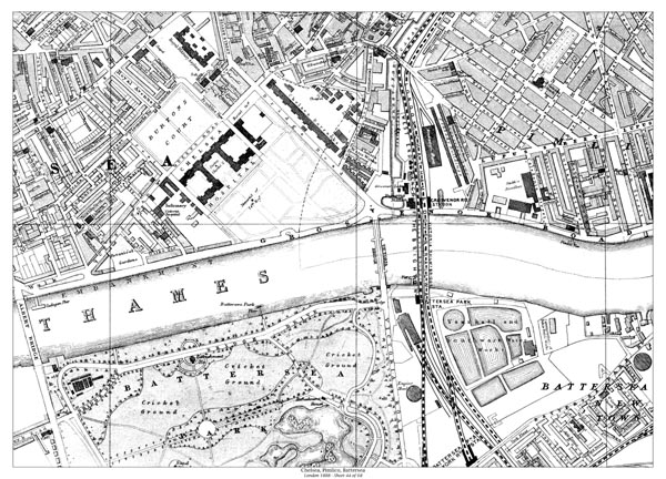
Old map of London in 1888 - Chelsea, Pimlico, Battersea (north)
Sheet 44 of 68:
North of the river: Royal Military Asylum, Chelsea Hospital, Chelsea Barracks, Albert Bridge, Victoria Bridge.
South of the river: Battersea Park (north), Vauxhall & Southwark Water Works.
PURCHASE THIS MAP INSTANT DOWNLOAD - £5.99
In Adobe .pdf format
PRINTED - A2 SIZE - £7.99
23 x 16 inches
Standard quality 90gsm bond
DOWNLOAD A SAMPLE PDF MAP <<CLICK HERE>> USE THE ZOOM TOOL FOR OPTIMUM VIEW