HOME | BOOKS | PRINTED MAPS | MAPS ON CD-ROM | GENEALOGISTS | CONTACT US | PRIVACY
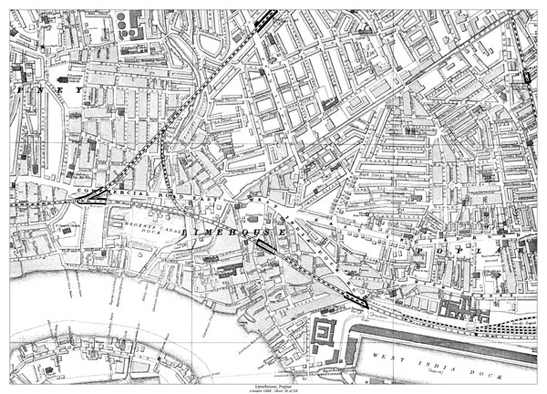
Old map of London in 1888 - Limehouse, Poplar
Sheet 36 of 68:
Also shows Stepney (east), Limehouse Workhouse, Poplar Workhouse, eastern Commercial Road East,
West India Dock Road, East India Dock Road, Regents Canal Dock, northwest part of West India Dock,
Stepney Station, Burdett Road Station, Limehouse Station, East India Docks Station,
and South Bromley Station on the northeast edge of the map.
PURCHASE THIS MAP INSTANT DOWNLOAD - £5.99
In Adobe .pdf format
PRINTED - A2 SIZE - £7.99
23 x 16 inches
Standard quality 90gsm bond
DOWNLOAD A SAMPLE PDF MAP <<CLICK HERE>> USE THE ZOOM TOOL FOR OPTIMUM VIEW